

The objective of this study of the island's vegetation is to stimulate spatial planning and town planning strategies to protect and connect the remaining sensitive ecological landscape units.
Commissioned by the Ministry of Public Housing, Spatial Planning, Environment and Infrastructures (VROMI) of Sint Maarten, a color vegetation map produced by CARMABI (Caribbean Research and Management of Biodiversity) and Wageningen University & Research (Netherlands) shows a 25% decrease in the overall vegetation cover on the Dutch side of the island since 1956. A decrease which can be attributed to massive urbanization and tourist development, overgrazing by introduced mammals (goats), the impact of hurricanes and the detrimental effect of invasive plant species.
The objective of this study of the island's vegetation is to stimulate spatial planning and town planning strategies to protect and connect the remaining sensitive ecological landscape units. All to prevent further loss of biodiversity and vital natural resources.
“Vegetation mapping is a useful tool for understanding the state of biodiversity and the species composition of a particular area (eg an island). These maps are used by a wide variety of actors, from scientists to policy makers, and are essential for spatial planning and the design of nature conservation and management strategies. Says the Dutch Caribbean Nature Alliance.
This tool is all the more relevant in a territory like the island of Saint-Martin, which is home to more than 100 species that are only found in the Lesser Antilles, and twelve only on the island. In addition, the types of vegetation associated with the hilly landscape (the dominant landscape of Saint-Martin) belong to the most threatened ecosystems in Latin America and the world.
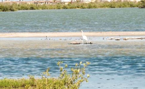
“Well-developed natural vegetation plays an essential role in ensuring balanced and healthy ecosystems. Areas with such vegetation influence soil properties, prevent erosion, aid in water retention, and provide important buffers between land and sea (preventing damage to coral reefs by sedimentation). Not to mention the importance they play in providing food and shelter for a wide variety of animal populations native to the island. »Recalls the Dutch Caribbean Alliance.
Five different types of vegetation - found in coastal areas - have totally disappeared in recent decades. The interdependence of ecosystems on the islands makes them vulnerable to the impact of habitat loss and fragmentation as well as the negative impact of grazing by introduced grazing mammals and invasive plant species. Of course, we must not forget the harmful effects of hurricanes and global warming.
Although there has been some regeneration, the overall process observed for Sint-Maarten is that of the loss of natural and semi-natural vegetation areas. The greatest disappearance took place in the western parts of the island, which in 1956 were characterized by the presence of two types of evergreen vegetation.
“In the Terres Basses area, a type of climax evergreen vegetation covering a large part of the area in 1956 has almost completely disappeared with the exception of a very small area still present but seriously threatened. Large areas west of the eastern hill range have been lost. It has been observed that the general trend shows that hills are regenerating while low-lying and coastal areas are degrading at a faster rate, resulting in a net loss of vegetation. This trend demonstrates the economic shift from mainly agricultural practices to an economy heavily dependent on tourism. Can we read in this study.
Towards a more sustainable future for Sint-Maarten
Vegetation maps similar to that produced in this report have been completed by Carmabi for other Dutch Caribbean islands as well. This includes maps of Curaçao (1997), Bonaire (2005), Saint-Eustache (2014) and Saba (2016). Since the 1980s, land use planning has become a hot topic, and understanding the current state of each island's land areas is essential both for sustainable land development and for the implementation of conservation and conservation strategies. catering.
The report ends with five recommendations to work towards a more efficient management of terrestrial nature on the island: establish a network of protected areas, control stray livestock, protect endangered plant species, an action plan against invasive species and long-term vegetation monitoring.
The findings of this report underline the importance of protecting and connecting rare and individual landscape units, such as those found in the Terres Basses and on the rare beaches that still have natural vegetation. It is also clear that the characteristic landscape ecological units of the high hills have a high conservation value which calls for protection.
7,688 total views


No comments