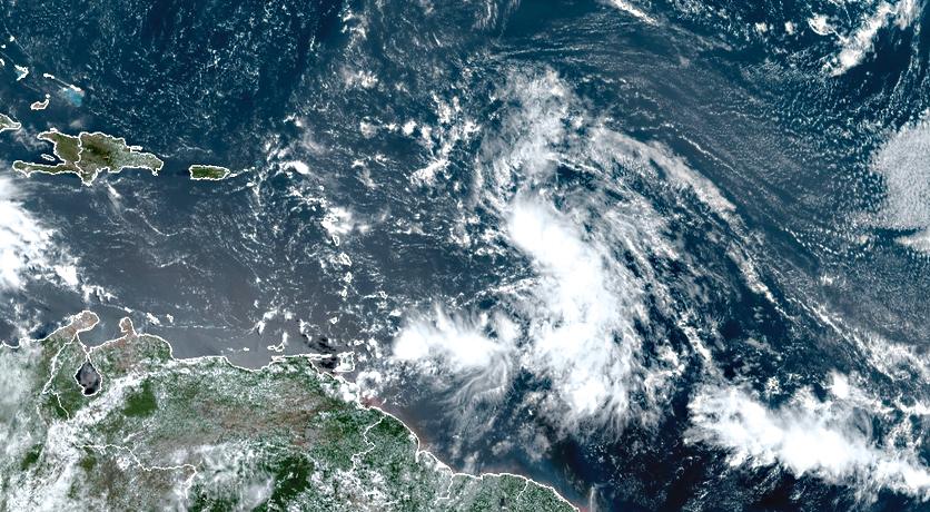
The strengthening of the tropical wave had been announced for several days by forecasters. It was yesterday a tropical depression about to evolve into a storm stage
Tropical Depression No. 13 formed last night and could strengthen over the next 24 hours to reach the tropical storm stage, forecasters at the National Hurricane Center warned yesterday. “The most likely scenario is that this phenomenon, if it intensifies, remains moderate in intensity as it approaches the West Indian arc. It could however generate an episode of stormy instability over the northern half of the Antillean Arc (from Martinique to the northern islands of the Lesser Antilles) ”noted Météo France yesterday in its cyclonic activity bulletin. In the northern islands, weather conditions should deteriorate as of today as the cyclonic phenomenon approaches. The passage of the system is expected slightly north of Saint-Martin and Saint-Barthélemy, but a shift in the trajectory towards the Northern Islands is not excluded by forecasters. As the situation evolves rapidly and regularly, the populations affected by the arrival of the cyclonic phenomenon are invited to monitor the evolution of the system, like milk on the fire. A storm alert has been issued by the National Hurricane Center for all the islands of the West Indian arc located north of Guadeloupe.
www.lepelican-journal.com
12,515 total views


No comments