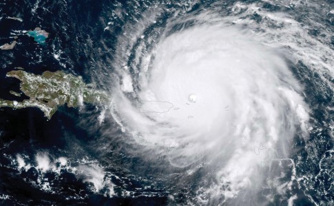
A few days before the month of September, historically the most active month of the hurricane season, activity beats its full in the Atlantic basin but no disturbance threatens the archipelago of the Antilles for the moment.
Three disturbances are currently evolving in the North Atlantic basin. One of them, located in the Caribbean Sea (1) will very likely become tropical storm Ida in the hours to come, on the 9thrd named cyclone system of the season. Its trajectory could take the disturbance to impact the Yucatán peninsula and the west of the island of Cuba by going north, warn meteorologists.
The second disturbance (2) is currently evolving north of the Atlantic Ocean and has little probability of developing into a cyclonic system. Whatever its evolution in the coming days, it should not concern inhabited lands.
The last (3) is located in the heart of the Atlantic Ocean, halfway between the African coasts and the archipelago of the Antilles. The tropical wave evolves in an environment favorable to its development and a tropical depression could form during the weekend. It has a 50% probability of development within 5 days, inform meteorologists. However, according to forecasters, the disturbance should quickly branch off to the north without its activity worrying the islands of the West Indian archipelago.
Mid-season review
Since June 2021, when the hurricane season officially begins each year, 8 hurricane systems have been named. These include tropical storms Ana, Bill, Claudette, Dany and Fred. So far only three hurricanes have been recorded. Category 1 hurricanes Elsa and Henri, which appeared on July 2 and August 21, respectively, and major category 3 hurricane Grace, which hit the Mexican coast on August 21 with winds of up to 205 km / h.
9,509 total views


No comments