
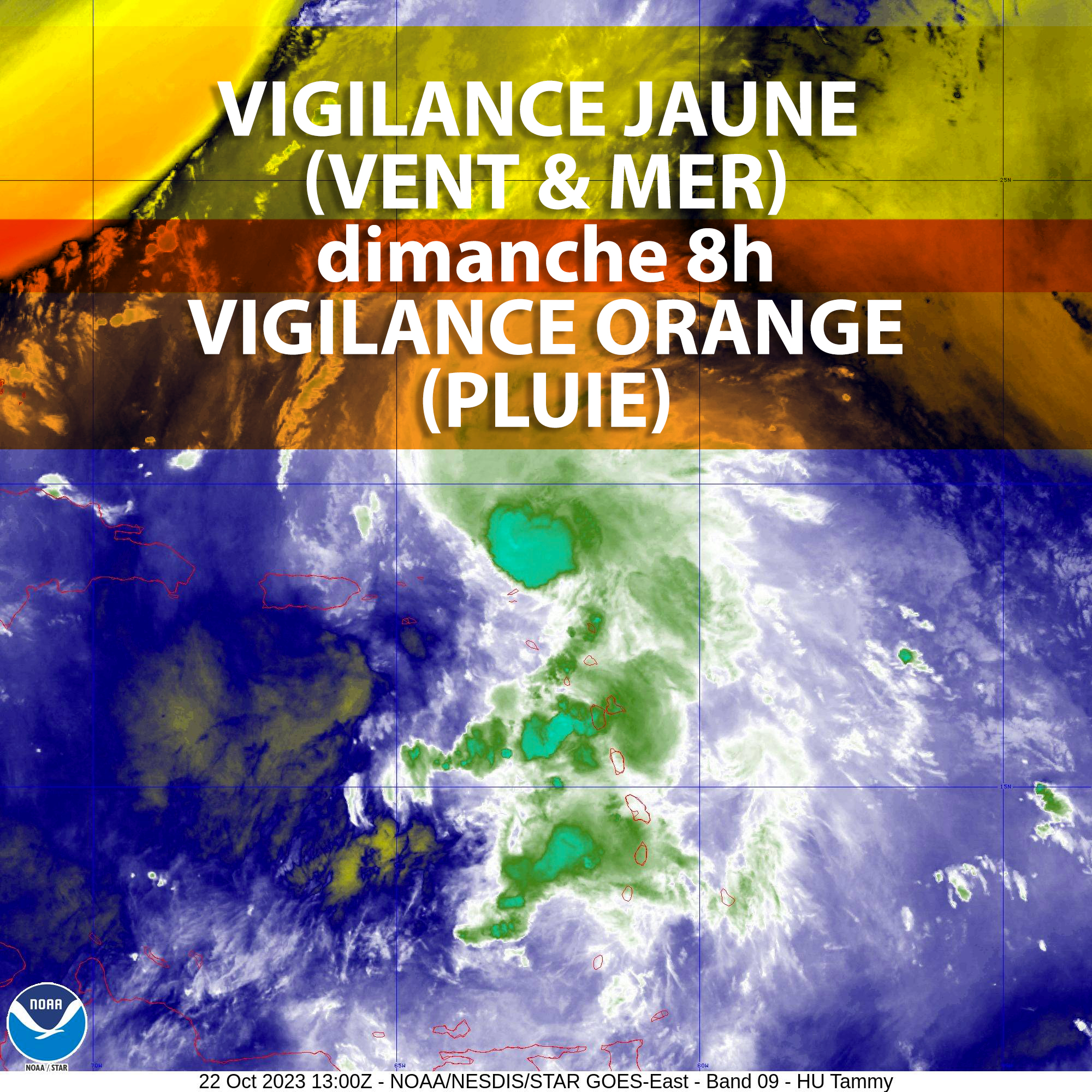
Reminder of Dangers:
Heavy rain and thunderstorms level ORANGE
YELLOW level submersion waves
Strong winds level YELLOW

Issued on: Sunday October 22, 2023 at 07:51 a.m. legal time (i.e. 11:51 UTC)
By: Guadeloupe Meteorological Center
Date and time of the next bulletin: Sunday 21/10/23 around 12 p.m. legal time.
Start of event: projects
Estimated end of event: Monday 23/10/2023 in the evening at the earliest.
Current Situation
Tammy is still a Category 1 hurricane
at 05:00 a.m. The hurricane is 90km east-north-east of Anguilla and was continuing its trajectory towards the north-northwest.
The system passed a little more than 60 km from Saint-Martin and Saint-Barth which were not subject to the strongest winds.
Forecasts
Heavy rain and thunderstorms
During this Sunday the showers will be frequent, they should intensify in the evening as TAMMY moves towards the North and continue until Monday morning. The stormy rains behind TAMMY are very active, they could bring accumulations of up to 100 mm to the islands during the episode. Locally, significant intensities could generate rapid flooding.
Vents
The wind is currently from the west. It is blowing at between 20 and 30 km/h. It gradually moves towards the southern sector during the day at between 25 and 35 km/h. Gusts are possible up to 100km/h, particularly in the evening under the squalls.
Wen
In the morning this Sunday, the sea calms down but it remains rough to strong due to northeast swells with waves of 2m. The swell orients during the day to the south-east with hollows of around 50m1.
The wind picks up seas from south to south-southwest during the day this Sunday and tomorrow Monday.
Unusual unrest on exposed coasts and localized flooding of low-lying parts of the coastline is possible.
Observed data
Wen
Over the last few hours the buoy has measured dips of 2m30 to 2m40 by swell from north-east to east and periods of 7 to 8 seconds
rains
not significant
Wind
Max bursts on the episode at present
76km/h in St-Barth at 4 a.m. this morning
73km/h in Grand-Case at 19 p.m. on 21/10/2023
Individual behavior measures recommended by the prefecture:
ORANGE WARNING HEAVY RAIN/STORMS: BE VERY CAREFUL!
Find out before starting a trip and be very careful.
Avoid mountain walks and hikes in relief.
If you live in a flood zone, secure your property that could be damaged and watch for rising water.
If your home may be threatened by a landslide, leave it or prepare to evacuate it quickly.
In the event of a storm: avoid using telephones and electrical appliances. Do not take shelter in a wooded area, near pylons or poles, or under an isolated tree.
——————————————————————————————————-
YELLOW WAVE-SUBMERSION WARNING: BE ATTENTION!
Find out about the weather situation and be particularly careful:
– if you have to practice risky sports outdoors,
– if your outdoor activities are located in an exposed area, on land, especially near cliffs, beaches and at sea of course.
——————————————————————————————————-
YELLOW WARNING SEVERE WINDS: BE ATTENTION!
Find out about the weather situation and be particularly careful:
– if you have to practice risky sports outdoors,
– if your outdoor activities are located in an exposed area, on land, particularly near cliffs, such as at sea of course.
——————————————————————————————————-
2,530 total views


No comments