

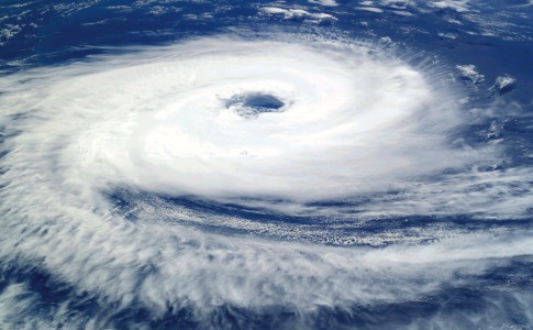
The system is very close to going into a tropical storm. This morning at 8 a.m., the disturbance is centered at about 15,5 ° N and 62 ° W, i.e. near Dominica, a little further south than expected
Approximately because the system is not very organized and its center is difficult to locate. This low is moving fairly quickly towards the NWW (285 °) at 35 km / h, but this forward speed will decrease in the coming days.
According to the Miami NHC, the planned trajectory will pass the system this morning over Dominica, during the day south of St-Kitts and then overnight over the Virgin Islands and Puerto Rico.
The minimum central pressure is estimated at 1007 mb. Maximum sustained winds are near 65 km / h, gusting to 80 km / h. Some strengthening is expected over the next 24 hours and the system, if it isn't already when you read this, should become Tropical Storm Isaias.
************************************************** **********************************************
Prefecture press release
> Stay tuned and make sure you are well prepared
The latest Météo France forecasts show a cyclonic system with a West North West trajectory. It is expected to reach the stage of tropical storm when it passes over the northern islands.
The first effects will cause a clear deterioration of the weather on our islands very early in the morning of Wednesday until Thursday noon.
• Forecasts
Rain : significant precipitation is expected over the Northern Islands. Accumulations of the order of 100 to 150 mm are expected over the entire episode. The first rains should reach Saint-Martin and Saint-Barthélémy at the end of the night from Tuesday to Wednesday and will continue during the day on Wednesday.
Wind: easterly winds between 80 and 90 km / h are expected on Wednesday. Gusts of the order of 110 to 120 km / h are possible, especially in thunderstorms.
Sea : the sea becomes heavy from this night from Tuesday to Wednesday with average troughs
from 3 to 4m in an easterly swell. Tomorrow, Wednesday, the sea is very rough with troughs
Medium reaching up to 5m, in a northeast swell in the morning, then east in the afternoon.
———————————–————————————————————————————————
In addition, in order to limit travel, schools currently hosting vacation classes or day camps will be closed on Wednesday and Thursday.
The Prefecture calls on the population to be extremely vigilant.
The procedures to be followed according to vigilance and the preparation of the emergency kit are available on the website of the Prefecture: www.saint-barth-saintmartin.
pref.gouv.fr
The services of the Prefecture are closely monitoring the development of this phenomenon.
Stay tuned for official messages and don't spread false information.
———————————–————————————————————————————————
Individual behavior measures recommended by the prefecture:
VIGILANCE ORANGE DANGEROUS SEA ON THE COAST: BE ATTENTIVE!
If possible, avoid sea trips, swimming and recreational water sports.
Be careful on the beaches: BEWARE of rollers and breaking waves!
Protect the boats by sheltering them or lifting them out of the water.
If you must stay on board, be especially careful when traveling and wear emergency equipment.
Be especially careful if you must go out to sea.
At sea, take all precautions to ensure your safety in the event of a fall into the water.
If you live by the sea, prepare to secure your belongings likely to be damaged by rising water levels (sea and tide).
ORANGE VIGILANCE FOR HEAVY RAINS / THUNDERSTORMS: BE ATTENTIVE!
Find out before starting a trip and be very careful.
Avoid mountain walks and hikes in relief.
If you live in a flood zone, secure your property that could be damaged and watch for rising water.
If your home may be threatened by a landslide, leave it or prepare to evacuate it quickly.
In the event of a thunderstorm: avoid using telephones and electrical appliances. Do not take shelter in a wooded area, near pylons or poles, or under a
isolated tree.
ORANGE VIGILANCE HIGH WINDS: BE ATTENTIVE!
Limit your movements.
Limit your speed on the road and especially if you are driving with a hitch.
Avoid walks especially on the coast.
Beware of falling trees or other objects.
Do not work on roofs and do not touch any electrical wires that have fallen to the ground.
Store or secure items exposed to wind or liable to be damaged.
Take all precautions against the consequences of a strong wind, unusual for the region.
8,149 total views


No comments